- Success Stories
- Environmental Resource Assessment & Management
New Heavily Desired High Resolution Land Cover Data for the U.S.
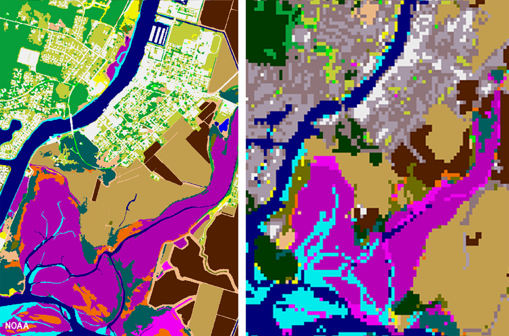
The National Oceanic and Atmospheric Administration recently announced the launch of the long desired high-resolution coastal land cover data. This highly anticipated data are available for most coastal areas of the U.S., including Alaska and the U.S. territories.
CSS employee owners contributed to the release of this data set by participating in production activities and providing quality assurance/quality control checks. In addition, the team has been presenting workflow processes and outputs, on-the-ground applications, and associated benefits of the data at conferences and to partners.
As part of this effort, CSS staff developed ESRI ArcGIS image services and a story map to facilitate distribution and understanding of the data. Following the NOAA press release, the land cover project team manager received an influx of questions expressing confusion regarding the data. CSS staff were tasked with rapidly developing this story map to better explain the points of confusion and direct users to the data download site. Staff completed this task within three business days of being assigned.
Previously, coastal land cover data was widely available at a 30-meter resolution. This new data is a 1-meter resolution product, which communities can use to improve sea level rise projections, protect communities from flooding, inform wetland restoration projects, and more. This is an especially important data set for Alaska, which has previously not had widespread land cover data available. Due to the costly nature of this high-resolution data, it was previously unobtainable for communities that couldn’t provide funding. Thanks to funding from the Bipartisan Infrastructure Law, NOAA was able to provide this data at a much larger scale.
Download the new high-resolution coastal land cover data through NOAA’s Digital Coast website,

See More CSS Insights
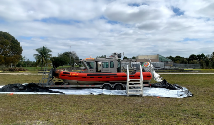
Large-Scale Decontamination Proves Successful
In the spring of 2022, we worked with the U.S. Environmental Protection Agency and the U.S. Coast Guard on a project called Analysis for Coastal Operational Resiliency-Wide Area Demonstration (WAD) which tests large scale decontamination following the release of surrogate bioagents. The team conducted a WAD at a military base in Virginia to test decontamination…
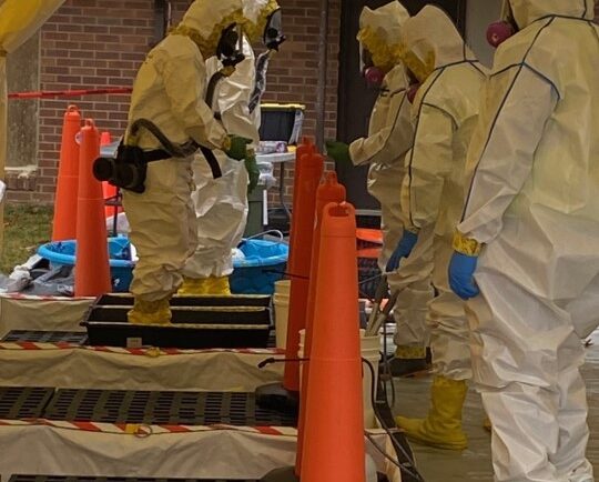
Developing a Decontamination Line Guide for EPA Responders
CSS employee owners supporting the Environmental Protection Agency’s (EPA) Scientific and Technical Assistance for Consequence Management (STACM) contract have been working with the National Chemical Preparedness Workgroup and Sub Workgroups to create a decontamination (decon) line guide and detailed drawing for EPA on-scene coordinators and EPA’s special teams to use for emergency responses and incidents. The…
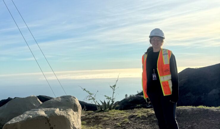
Supporting Response Efforts Following California Fires
Following the fires that devastated Los Angeles, California and surrounding areas in January 2025, CSS employee owners were deployed to the area as a subcontractor to Weston Solutions, Inc. to assist with the response. This effort supports U.S. Environmental Protection Agency (EPA) Region 9 Superfund Technical Assessment & Response Team (START) program. Initially, a CSS…