- Success Stories, Uncategorized
- Satellite Science & Environmental Intelligence
Engaging in New and Emergent Satellite Technologies
CSS employee owners (formerly Riverside employees) support the National Oceanic and Atmospheric Administration’s (NOAA) National Environmental Satellite, Data, and Information Service’s (NESDIS) Center for Satellite Applications and Research (STAR). STAR is the science arm of NESDIS, which acquires and manages the nation’s environmental satellites for NOAA. Satellite observations are critical to informing situational awareness and numerical weather prediction applications. These applications provide guidance to users and stakeholders on environmental threats at multiple timescales, from current analyses to medium-range and seasonal-to-subseasonal lead times.
As a subtask, CSS employee owners support the NESDIS Research and Technology Maturation for Exploitation of Emerging Technology (RTMEE). Objectives for this task are to ensure STAR is engaged in new emerging technologies, numerical techniques, new observing systems and in supporting next-generation systems, to keep all aspects of STAR activities relevant for the future. This is achieved by undertaking research and technology maturation activities that will transition to supporting mission activities and advanced programs in NOAA. The work will ensure that the quality of the data produced by NOAA meet or exceed international standards.

For their role, CSS employee owners supporting RTMEE are responsible for collaborating with NESDIS Systems Architecture and Engineering (SAE) and STAR staff to explore new technologies in support of NOAA’s mission. CSS leverages SAE and STAR expertise in satellite data and applications required to address the needs of data exploitation, validation, verification, and quality and impact assessment opportunities. CSS supports the advancement of NOAA’s observational and data system capabilities with both internal and external NOAA partners and demonstrates the value of artificial intelligence to efficiently exploit the information content of microwave sensor concepts and quantify the impact on NOAA systems. In addition, we support the evaluation and exploitation of 3D-wind measurements to help determine the impact of the potential deployment of new types of satellite sensors dedicated to filling gaps to improve the quality of weather and climate data.
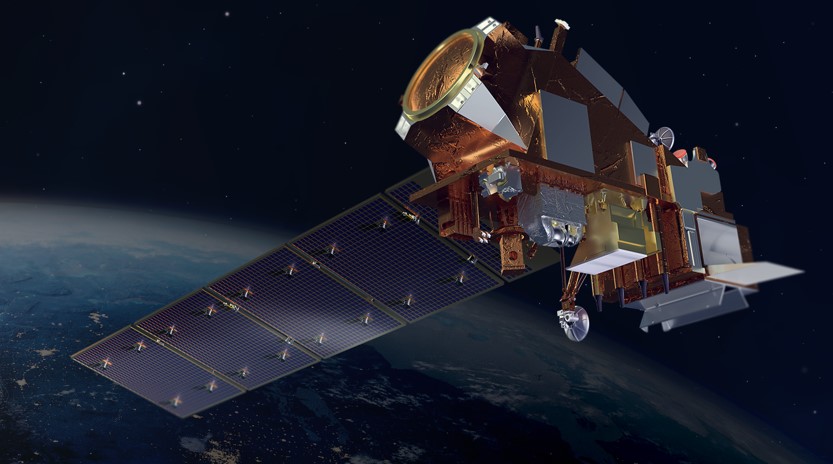
Feature photo credit: Artist rendering of NOAA 21 satellite (credit: NOAA)
See More CSS Insights

Overcoming COVID-19 Challenges
Great job to our team supporting our contract with the U.S. General Services Administration on assisting the client with conducting a year’s worth of environmental, health, and safety surveys in just six months! Due to limitations with COVID-19, the team was unable to conduct their surveys on their usual timeline and instead had to work…
Rapid Reporting of a Close Call Incident
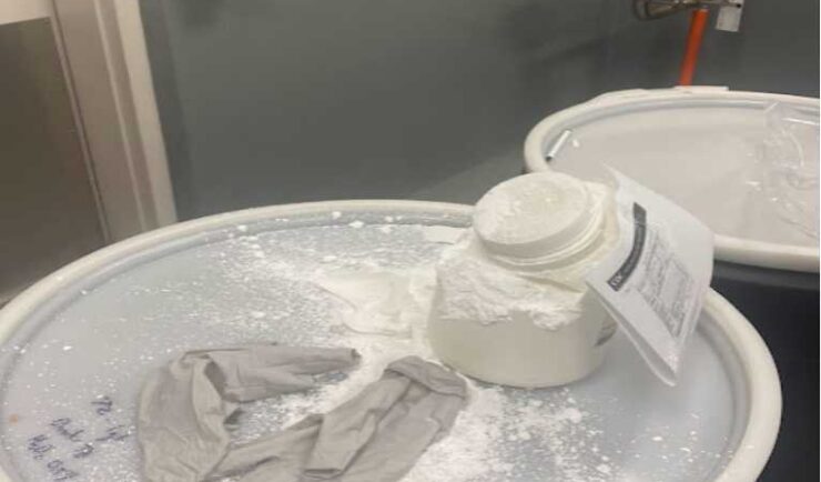
CSS Safety Protocols During a routine collection of waste, a container of white powder disintegrated without warning, causing the powder to spill and be expelled into the air. Thanks to CSS’s safety protocols and quick response, our Center for Disease Control waste disposal staff was able to assess the situation and respond to the chemical…
Over 2000 River and Stream Samples Analyzed
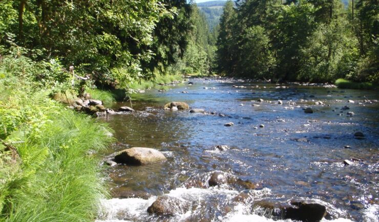
Every five years teams supporting U.S. Environmental Protection Agency’s National Aquatic Resource Survey—consisting of tribal, state, and federal partners—collect samples from over 2000 river and stream reaches throughout the United States. CSS analytical chemists support this effort by processing the samples and then analyzing them for various chemicals to help characterize their water quality. The…