- CSS News
- Environmental Resource Assessment & Management
Presenting and Networking at Coastal Geotools 2023
Several of our employee owners attended the Coastal Geotools conference in Charleston, SC. This conference is the largest conference for coastal resource managers focusing on data, tools, technology, and other geospatial solutions coastal managers need to serve their communities. With many of our staff and potential employee prospects in attendance, we provided a bronze sponsorship and staffed a booth to discuss our company and project examples with the coastal management and geospatial community. Several staff presented their projects including offshore wind site suitability modeling, and ocean economy and offshore planning data development. In addition, staff provided tool demonstrations during the Tool Showcase.
This conference enables our staff to learn new skills and approaches from their peers, and expand their networks within the geospatial community.


See More CSS Insights
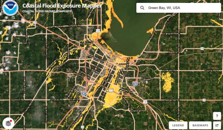
Expanding a Popular Flood Exposure Tool
We recently assisted our client, the National Oceanic and Atmospheric Administration’s (NOAA) Office for Coastal Management, with updating one of their most popular tools, the Coastal Flood Exposure Mapper.
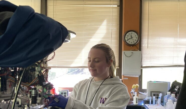
Monitoring Algal Blooms for Harmful Toxins
CSS employee owners support NOAA’s National Centers for Coastal Ocean Science (NCCOS) Harmful Algal Blooms (HAB) Sensor Development Team in their efforts to detect and monitor these harmful algal blooms in coastal waters where they are likely to occur. HAB monitoring is critical for detecting harmful toxins produced by some algae. When present in over…
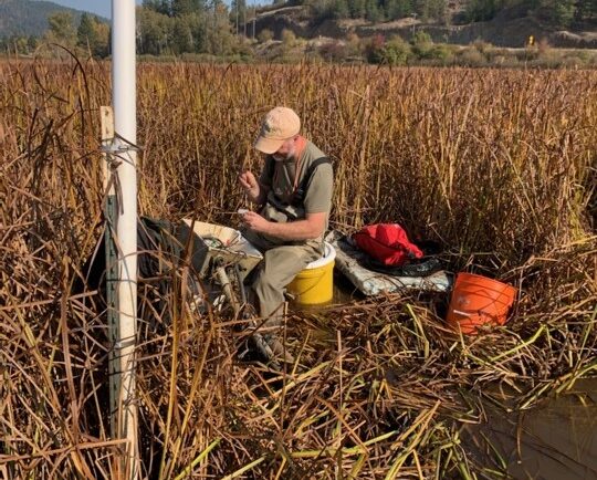
Installing Environmental Monitoring Stations
Our field crews installed/updated two environmental monitoring stations in remote locations in the Pacific Northwest. Multiple types of sensors were installed including air and soil temperature, precipitation, soil moisture and soil redox potential. These stations provide data for designing and evaluating soil remediation projects for U.S. Environmental Protection Agency’s Office of Research and Development. Installing…